Southern California
At Enhanced Scanning, we often talk about how we use several different tools to get the best results on our projects. However, it’s also the case that we use the same tool on several different types of projects. For example, we use ground penetrating radar (GPR) to scan for underground utilities like electrical, water, and gas lines, but we can also use GPR on archaeological sites.
With GPR scans, archaeologists can “explore” a dig site before actually breaking ground. They can uncover the most likely places for buried artifacts, discover any soil structure changes, and identify any risks for damage. Knowing certain facts about the site prior to the dig can save archaeologists a tremendous amount of time and effort and can result in a more successful dig.
No two archaeology jobs are the same, however. Sometimes you have to accommodate budgetary constraints or look for very small anomalies. Our job in the La Jolla peoples’ region in Southern California required both.
Making the Most of GPR Scanning
Generally, when we get called to scan an archaeological site prior to a dig, we use both ground penetrating radar and a magnetometer. The reason we use both tools is because each has different strengths. For example, GPR can detect differences between soil and non-soil materials such as metal, PVC, and bone. In contrast, a magnetometer can locate the distinctive magnetic anomalies present in burnt materials, such as hearths.
Unfortunately, the budget for this particular project didn’t allow for both a magnetometer and a GPR antenna to be used. Since we’re all about solutions here at Enhanced Scanning, however, we found a way to work within their budget and gather the data they needed using only GPR.
Using Ground Penetrating Radar on an Archaeological Site
The archaeologists on this project aimed to document the La Jolla people’s movement and settlements. Specifically, they were trying to determine whether the La Jolla people had brought rocks from other areas to build structures. Locating these rocks would indicate that they had inhabited the area and had not just passed through.
The archaeologists wanted to check a large area (about 130’ x 80’) near a beach and brought us in for GPR scanning to help find evidence of the structures underground so they could determine where they should excavate.
Since the dig site was far enough from the ocean shore, the sandy soil was very dry. Fortunately, dry sand is among the best types of soil for a GPR scan because the sand does not attenuate the radar wave as much as wet sand, clay, or mud would. The site conditions allowed our GPR antenna to pick up on changes in subsurface electrical properties, called dielectric constants, quite effectively. Ground penetrating radar was able to detect that dielectric contrast.
In this case, we needed ground penetrating radar to detect the dielectric contrast between native soils and that of rocks that had been brought in from other places. If we could discern the presence of rocks in the data, and those rocks formed any patterns, like an arc, a 90-degree angle, or any other features that don’t generally occur in nature, this could indicate that the indigenous peoples had built something in that spot.

Our Process for Using GPR Scanning on an Archaeological Site
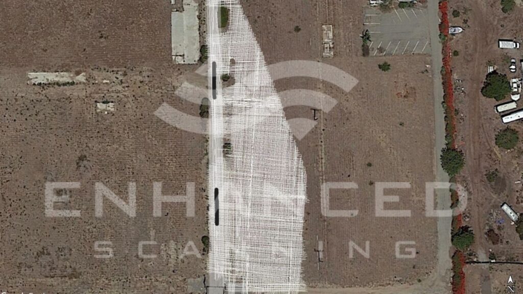
On a typical GPR scanning project, like when we’re looking for a steel pipe underground, we would create a grid of transects, generally every three to five feet. This is because a steel pipe is long enough to be detectable at numerous points during our scan. But on this project, the grid needed to be much tighter because we were searching for any small anomaly that showed a dielectric contrast from the native soils. So, in this case, our transects were on twelve-inch centers.
On archaeological sites, instead of marking targets as they are found, like we do when with utility locating, we collect the data and take it back to the office for processing. Based on the data, we identify the areas that indicate a need for further investigation (i.e., where the archaeologists should dig).
We use a program called Geolitix to process the data, and then we create a cube of data with x, y, and z data points. Then, we slice through the data to find anomalies.
For instance, maybe we find nothing the first foot down, but then some anomalies start appearing two feet down and are more evident three feet down. Then, at four feet down, those anomalies start disappearing, and at five feet down, no anomalies are noted. This sort of granularity helps archaeologists narrow down a time period during which the people might have inhabited the area.
On the La Jolla people’s site, the archeologists discovered quite a few “middens,” which is an archeological term for domestic waste piles that consist of clusters of food refuse. Specifically, these were shell middens, which are made up mainly of mollusk shells.
Working with Archaeologist for the Best Results
At Enhanced Scanning, we always work with our clients to ensure they get the best results possible within their budget. Our approach was no different for this project.
We spent more than twenty hours collecting data and then additional time processing the data to help ensure that the GPR scanning gave our archaeologist clients the information they needed for a successful dig.
If you’re interested in using GPR scanning prior to your next archaeological dig, contact us today to set up a consultation.